
What the day feels like
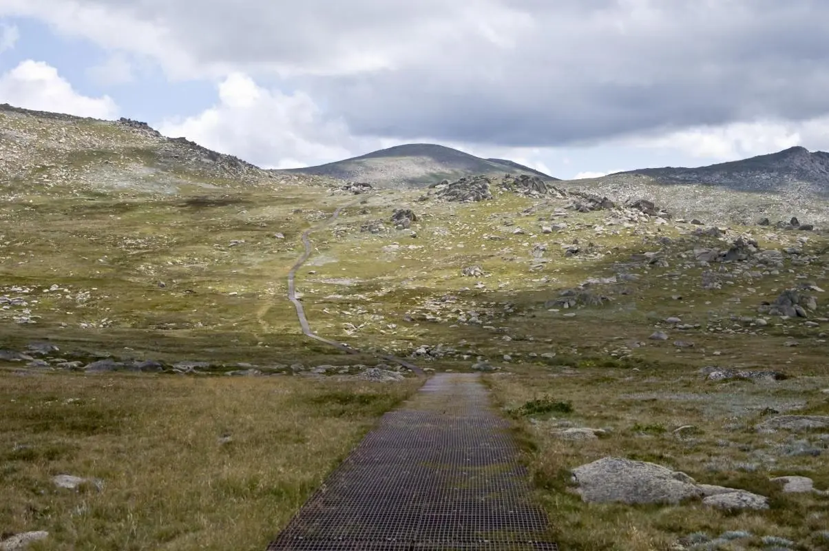
If you stand on the broad granite shoulder of Mt. Kosciuszko on a clear February morning, the wind reads you like a map. It pushes and pulls—an alpine current that has been shaping this high-country for millennia—nudging you toward the low, rounded summit where the horizon opens into a sweep of twin ridgelines, tarns, and the pale blue cut of distant ranges. The trail underfoot changes here from firmer dirt to weather-polished rock and then, in summer, to carpets of alpine wildflowers that tilt their faces to the sun. This is Australia’s roof: not a jagged peak, but a gentle plateau that demands a different sort of respect—one for fragility and for altitude.
Mt. Kosciuszko National Park sits in the Snowy Mountains, an hour or two south of Canberra and roughly five hours’ drive from Sydney. For many visitors the summit is the prize, but the park’s real character comes in its contrasts: hollowed glacial valleys, short-lived snowfields, and treeless alpine grasslands that host plants found nowhere else on the continent. The highest mainland point, Kosciuszko rises to 2,228 meters (7,310 ft). Nearby Lake Cootapatamba, a glassy alpine tarn below the summit, is Australia’s highest lake and a favorite lunchtime stop for walkers.
The mountain’s name carries layers of history. Polish explorer Paweł Edmund Strzelecki named it in 1840 after Tadeusz Kościuszko, a European freedom fighter he admired, while the land itself has been the traditional country of the Ngarigo, Wolgalu and Southern Ngunnawal peoples for thousands of years. Their seasonal knowledge of the high country—when to harvest bogong moths, where to camp, and how to read the moods of the range—remains part of the park’s living memory.
Geologically the Snowies are old and patient. Unlike the cragged peaks of the Alps, Kosciuszko’s summit is the remnant of weathered granite and uplifted sedimentary layers. It’s a place that feels horizontal rather than vertical; the effort here is cumulative—distance, exposure to wind, and sun at altitude rather than technical climbing. In winter the park becomes a different world: thick snow, compacted trails, and Australia’s largest ski fields—Thredbo and Perisher—nearby. In summer the trails are open, the wildflowers explode, and the air is dry and sharp.
Practical routes are simple and deceptively sociable. From Thredbo, many hikers take the chairlift partway up the mountain, then follow a well-graded path that becomes a wide, sandy trail and later a rock-strewn boardwalk to the summit. It’s about 13 km round-trip and commonly takes 4–6 hours, depending on pace and how often you stop. From Charlotte Pass the walk is shorter—roughly 6 km round-trip—starting at a higher elevation which makes it an attractive option if you want a quicker summit day and a chance to visit Lake Cootapatamba. Both routes are well-marked and maintained, but remember: alpine weather turns fast. A cloudless dawn can become a sleet-slashed afternoon in minutes.
Why hikers come isn’t simply to tick Australia’s highest point off a list. It’s the clarity—the view that establishes scale without spectacle—and the way the landscape rewards small attentions: a sudden patch of snow still clinging to a gully in March, a rare alpine grasshopper flicking away, or the soft croak of a rosella on the edge of a heath. This is a walk that allows time for these small discoveries.
For planning, be pragmatic. Even in summer, temperature drops at altitude are real and UV exposure is strong—bring layers, sunscreen, and a hat. Water sources are limited and fragile: carry at least two liters per person and a lightweight filter if you plan to be out longer. Wear sturdy, broken-in boots; the trail’s hard-packed sand and rock can be deceptively punishing on ankles and knees after hours of walking. If you’re visiting in winter, call the local visitor center—ski lifts, road closures, and avalanche conditions matter.
Camping is allowed in designated areas and gives you the rare chance to watch dawn over the Main Range, but the park’s high alpine vegetation is fragile; stick to established campsites and platforms. For a more serviced approach, base yourself in Jindabyne or Thredbo—both towns offer rental gear, cafes, and shuttle services during peak seasons.
Conservation here is practical: stay on boardwalks where provided, avoid trampling cushion plants, and carry out what you bring in. The alpine zone regenerates slowly; a footprint can last for decades. If you plan to visit multiple sites in the park, consider a guided walk—rangers and local guides add context about geology, indigenous heritage, and seasonal ecology that enriches the experience.
At its best, a day on Kosciuszko is quiet and steady: a measured elevation gain punctuated by panoramic breaks and the kind of conversations that fall into a different rhythm away from the city. It’s approachable enough for confident day-hikers and rewarding for anyone keen on alpine ecology, history, and clear, far-reaching landscapes. And whether your reward is a photo of the broad summit cairn or a quiet moment by Lake Cootapatamba, the mountain’s invitation is simple: come prepared, move deliberately, and let the slow lines of the Snowy Mountains teach you a new pace.
Trail wisdom
Small choices, better day.
Start early
Begin before mid-morning for calmer winds, stable weather, and better light for photos; afternoon storms are common in alpine areas.
Layer for wind, not just cold
Bring a lightweight windproof and an insulating mid-layer—temperatures and wind exposure change quickly on the plateau.
Respect boardwalks and vegetation
Stay on designated paths to protect fragile alpine plants that recover slowly from trampling.
Carry enough water
Bring at least 2 liters per person; do not assume natural sources are available or safe without treatment.
Local knowledge
Read the place, not just the route.
Watch for native species including crimson rosella, eastern grey kangaroo / wallaby.
Keep an eye out for wildlife during the transition between areas and habitats. Respect distance guidelines.
The alpine vegetation is extremely fragile—stick to boardwalks and established trails, and carry out all waste to minimize impact.
Follow the guide's instructions on size limits, ethical handling, and leave-no-trace practices.
Lake Cootapatamba—an intimate, high-elevation tarn just below the summit. The Main Range boardwalks—less crowded spots with wildflower displays and expansive views
Locally recommended viewpoints and quiet spots known best to local operators.
Named by Polish explorer Paweł Edmund Strzelecki in 1840 for Polish national hero Tadeusz Kościuszko; the area is also the traditional land of the Ngarigo and surrounding Indigenous peoples.
Maritime roots and regional tradition shape the waterways and working coasts.
Seasonal guide
Four versions of the same landscape.
Spring
Best forwildflowers · birdwatching · shoulder-season hiking
Challengesmuddy sections from melt · unpredictable snow patches
Spring brings wildflowers and migrating birds but expect patchy snow and muddy trailheads during thaw.
Summer
Best forclear summit views · long daylight hikes · wildflower blooms
Challengesstrong UV and sunburn · afternoon thunderstorms
Summer offers the most reliable access and vivid plant life; start early to avoid stormy afternoons and protect against intense sun.
Fall
Best forquiet trails · autumn colors in valleys · cool, crisp hiking
Challengesshorter days · early snow possible
Fall is quieter with crisp air and clear visibility; pack warm layers as nights get cold and weather can change quickly.
Winter
Best forskiing and snow sports · snowshoeing · classic alpine scenery
Challengesroad closures · requiring snow gear and skills · limited services
Winter turns the park into a snow playground—access depends on closures and you’ll need proper winter equipment and knowledge.
Pack with intention
What to bring.
Good to know
Common questions.
From Thredbo it’s about 13 km round-trip and commonly takes 4–6 hours; from Charlotte Pass it’s shorter—roughly 6 km round-trip—and can take 2–3 hours depending on pace.
Plan the edges
The details that make the day easier.
Mt. Kosciuszko is the highest peak on mainland Australia at 2,228 meters (7,310 ft), and Lake Cootapatamba below the summit is the country’s highest lake.
The Snowy Mountains blend rural NSW hospitality—try local trout dishes and hearty pub meals in Jindabyne, sample craft beer, and look for Indigenous cultural tours that connect the land’s human history to the alpine environment.
- Getting there
- 4–5 hours drive from Sydney; nearest service towns Jindabyne and Thredbo. Permits: vehicle and national park entry fees may apply. Best access: summer for hiking, winter for snow sports. Health & safety: prepare for rapid weather changes, carry water, wear sun protection.
Stay on boardwalks and marked trails to protect slow-growing alpine plants; pack out all waste, avoid bringing firewood, and support local conservation programs focused on alpine recovery.
Explore by topic
Follow the threads.
Keep exploring
Make the story part of the trip.
 Related story
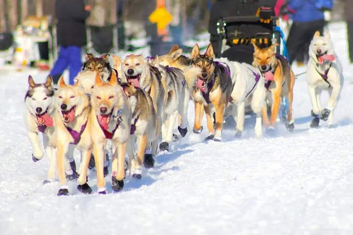
Compress the classics of Alaskan winter into a single weekend: dog sleds across frozen lakes, a snowmobile backcountry transfer, private cabins and nightly aurora hunts. This is an immersive, comfortable entry into the Iditarod world.
 Related story
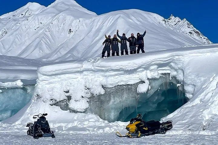
Three days, guided snowmobiles, and a base at Alpine Creek Lodge—this expedition mixes backcountry thrills with lodge-side comforts as you ride toward the Maclaren Glacier and the raw winter of the Denali Highway.
 Related story
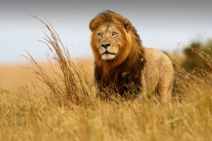
From Robberg’s wind-scoured cliffs to cave chambers and an open 4x4 game drive, this five-day Garden Route loop packs seaside hikes, whale watching and wine into one efficient, well-paced adventure.