
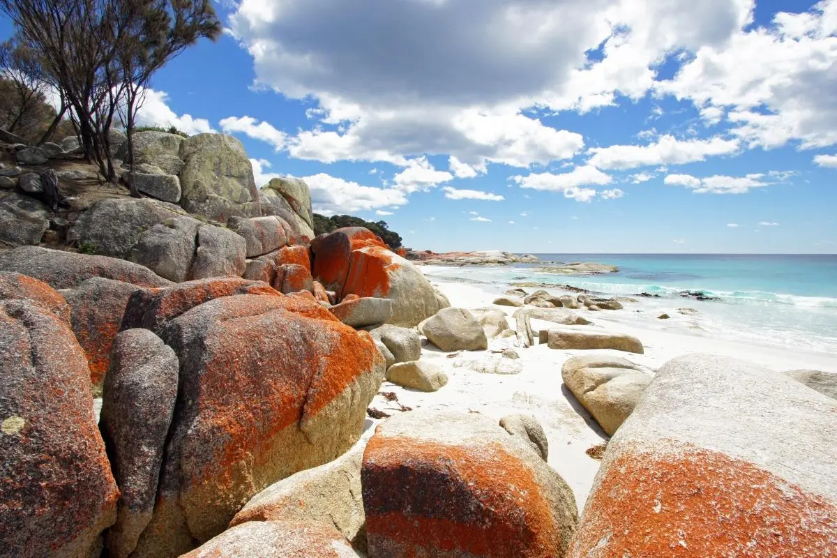
What the day feels like
On a cool dawn the granite boulders at Binalong Bay burn like embers—an impossible orange against white sand and a sea that flips from pewter to turquoise in a single stride. You move slowly, boots and sand alternately claiming purchase, while the surf at your feet seems to dare you to go farther. That’s the peculiar contract here: the coast invites measured steps and rewards them with vistas that feel private, even when maps show a place stretched across tens of kilometres. This place is the Bay of Fires, or Larapuna in palawa kani, Tasmania’s celebrated corridor of fire-streaked stones, wind-sculpted dunes, and small-boat coves.
The obvious magnet is the color—the vivid orange lichen that cloaks the coastal granite like a living paint job. It’s a geological love letter: ancient rocks smoothed by ice-age seas and then dressed by lichens that thrive in the salty, windy air. Captain Tobias Furneaux named this stretch the Bay of Fires in 1773 after seeing Indigenous fires along the shore; the landscape still feels shaped by both human history and the slow weathering of stone and tide.
The best way to experience Larapuna is on foot. Multi-day hiking tours—ranging from local 4-day Larapuna hikes to longer island-spanning discovery trips—are common, and the Bay’s accessible coastal geometry makes it well suited to several styles of adventure. On a guided 3–4 day hiking loop you’ll average 10–15 kilometres a day over mostly gentle terrain: packed sand, shell-grit, and stubbly coastal scrub, with short rocky sections around headlands. There’s very little elevation gain, but the wind is a consistent variable; it can be a quiet companion or an assertive force that pushes your rhythm.
Photography is another language here. Workshops based in St Helens, like the three-day photography retreats, follow the light—sunrise on open beaches, low-slung sunsets that set the orange boulders ablaze, and star-rich nights that, when clear, let the Milky Way watch over the coast. Wildlife and birdlife punctuate the days: little penguins in the shallows, sea eagles cruising thermals, and wallabies pausing like punctuation on dune backs. Guides who know where to look—around tidal pools, rocky outcrops, and reed-lined creeks—lift the experience from pretty to memorable.
Culturally the Bay of Fires is Larapuna to the region’s Palawa people, and the area is threaded with that presence. Stories and place names persist even as tourists arrive each season; respectful visitation—staying on tracks, not moving stones, and acknowledging local custodianship—helps preserve both the ecology and the deeper human history. The conservation ethos is also practical: dune grasses hold the sand like hidden fingers, and once disturbed the soft architecture of the beach changes. Campers and hikers are asked to use designated sites, pack out what they pack in, and not to remove lichen or shells.
For planners: there are two typical entry points. Many travellers base in St Helens or Binalong Bay (the latter is essentially a coastal village with direct beach access), while others join transfers from Launceston for private day trips. Multi-day guided hikes provide meals, shelter, and local knowledge—ideal if you want light packing and deeper context. Self-supported hikers should expect minimal services along the coast: water is limited, phone reception is patchy, and weather can change fast.
Practicalities that matter on the trail: a low-centre hiking shoe or light boot that sheds sand and water is preferable to heavy ankle boots; gaiters are a bonus for windy days. Bring a reliable water system—1.5–3 litres per person per day depending on temperature—and plan camps where facilities are confirmed. Tide awareness is important if you’ll be walking the base of rocky headlands; the surf has a way of reminding you who’s in charge. If you’re there for photography, bring a sturdy tripod, neutral-density filters for long exposures at sunrise and sunset, and a wide-angle lens to capture the sweep of sand and sky.
The Bay of Fires’ seasons alter the choreography. Spring unfurls wildflowers and milder winds; summer brings inviting swims but more visitors; autumn cools the air and sharpens the light; winter can be raw and cinematic, with dramatic seas and fewer people. Guided tours—3-, 4-, and 6-day itineraries—run year-round with variations to suit weather and wildlife windows. For those who want wildlife as part of the itinerary, combine the coast with inland stops offered on longer discovery tours: platypus at dawn, nocturnal visits to see Tasmanian devils, and walks that thread rainforest gullies and waterfall gardens.
You don’t need to be a technical climber or an expert navigator to fall in love with Larapuna—just willing to move deliberately and to listen to the coast. The Bay of Fires is both accessible and generous: it gives you long quiet sands for solitary reflection, tumbled rocks for dramatic frames, and warm local hospitality in St Helens when you return. Walk slow. Look closely. Let the shoreline pull at a different speed—one that makes time feel, for a few days, very much your own.
Trail wisdom
Small choices, better day.
Respect the lichen
Do not remove or stand on the orange lichen-covered boulders—these organisms are fragile and central to the Bay’s distinctive color.
Watch the tides
Route around headlands during high tide or plan inland detours—sections can be impassable at peak tide.
Pack water and filtration
There are limited potable-water points along the reserve—carry 1.5–3L and a lightweight filter for multi-day trips.
Use local guides for deeper context
Guided multi-day hikes and photography workshops offer safety, local knowledge, and conservation-minded camping options.
Local knowledge
Read the place, not just the route.
Watch for native species including little penguins, eastern grey kangaroo / wallaby.
Keep an eye out for wildlife during the transition between areas and habitats. Respect distance guidelines.
Stay on marked tracks, avoid moving rocks or lichen, and use designated campsites—these practices protect dune systems and sensitive coastal ecology.
Follow the guide's instructions on size limits, ethical handling, and leave-no-trace practices.
Eddystone Point lighthouse and nearby rock platforms (less visited northern headland). The Gardens and small tidal pools north of Binalong Bay for intimate sea-life viewing
Locally recommended viewpoints and quiet spots known best to local operators.
The coast was named 'Bay of Fires' by Captain Tobias Furneaux in 1773 after seeing coastal fires; the area is known as Larapuna to the Palawa people.
Maritime roots and regional tradition shape the waterways and working coasts.
Seasonal guide
Four versions of the same landscape.
Spring
Best forwildflowers · milder weather · birdwatching
Challengesvariable winds · patchy road repairs after winter · cool nights
Spring brightens the dunes and produces bird activity; days are comfortable for longer coastal walks but nights can still be cold.
Summer
Best forswimming · long daylight photography · family beach trips
Challengesmore visitors · occasional hot days · limited shade
Summer offers warm water and long light windows—expect more people and plan camps early to secure spots.
Fall
Best forclear light for photography · cooler hikes · fewer crowds
Challengescooler sea temperatures · shorter days
Autumn sharpens color contrasts and reduces crowds—sunsets are particularly crisp for photographers.
Winter
Best fordramatic seas and skies · solitude · night-sky viewing on clear nights
Challengesstorms and strong winds · rough seas · limited services
Winter is raw and atmospheric; suitable for experienced, well-prepared travelers who expect limited comforts.
Pack with intention
What to bring.
Good to know
Common questions.
Spring (September–November) and autumn (March–May) offer mild weather, good light for photography, and fewer crowds; summer is warmest for swimming but busier.
Plan the edges
The details that make the day easier.
Captain Tobias Furneaux named the Bay of Fires in 1773 after observing Aboriginal fires along the coastline; the orange color comes from lichens that colonize the granite.
St Helens offers fresh seafood, local artists, and small cafes; try scallops or Pacific oysters and visit galleries that showcase coastal-inspired Tasmanian work.
- Nearest hub
- St Helens (20–30 min drive to core beaches). Access: sealed roads to Binalong Bay; some tracks and car parks are unsealed. Permits: check park signage for camping rules. Mobile reception: patchy. Services: fuel and basic shops in St Helens.
Follow Leave No Trace: use designated campsites, don’t remove lichen or shells, and support local eco-certified guides to reduce impact and ensure cultural respect.
Explore by topic
Follow the threads.
Keep exploring
Make the story part of the trip.
 Related story
Compress the classics of Alaskan winter into a single weekend: dog sleds across frozen lakes, a snowmobile backcountry transfer, private cabins and nightly aurora hunts. This is an immersive, comfortable entry into the Iditarod world.
 Related story
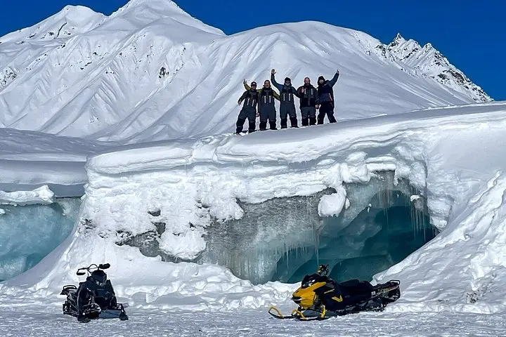
Three days, guided snowmobiles, and a base at Alpine Creek Lodge—this expedition mixes backcountry thrills with lodge-side comforts as you ride toward the Maclaren Glacier and the raw winter of the Denali Highway.
 Related story
From Robberg’s wind-scoured cliffs to cave chambers and an open 4x4 game drive, this five-day Garden Route loop packs seaside hikes, whale watching and wine into one efficient, well-paced adventure.